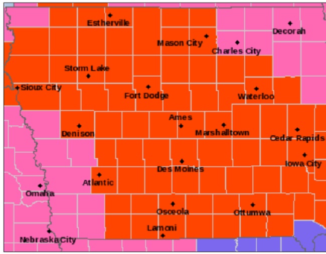
A very dangerous winter storm system will pass through western and central Iowa Thursday night and all day Friday, according to the National Weather Service, followed by life-threatening wind chills from Saturday into next week.
The NWS office in Johnston has issued a winter storm warning until 10 a.m. Friday, when a blizzard warning will then go into effect until 6 a.m. Saturday. A wind chill watch will follow from Saturday evening through Tuesday morning.
“Storms of this magnitude are fairly rare,” the NWS said Thursday, “with recurrence around once or twice per decade.” Only emergency travel is advised, especially by Friday afternoon and Friday night.
The multi-faceted severe winter storm will start Thursday night, with snow spreading into the state with heavy accumulations and persisting into Friday. Winds will then increase Friday morning, with life-threatening blizzard conditions expected Friday afternoon and night.
Snow accumulations of 6 to 10 inches by late Friday afternoon are forecast, followed by winds gusting as high as 45 mph. Visibilities below one-quarter mile will be common, with whiteout conditions. Wind chills Saturday could reach 30 to 45 below zero.
Travel will become very difficult by Friday morning and might be impossible in some rural areas Friday afternoon and Friday night. Blowing snow will significantly reduce visibility, with whiteout conditions likely.
The dangerously cold wind chills could cause frostbite on exposed skin in as little as 10 minutes. These temperatures and wind chills can be life threatening for stranded motorists. If you must travel, keep an extra flashlight, food and water in your vehicle in case of an emergency. If you get stranded, stay with your vehicle.
Monitor the latest forecasts for updates on this situation. For the latest travel conditions, check the Iowa 511 app, www.511ia.org or dial 511.
ThePerryNews.com will update this weather story as forecasts evolve.


